- 수도권
토지이용
-
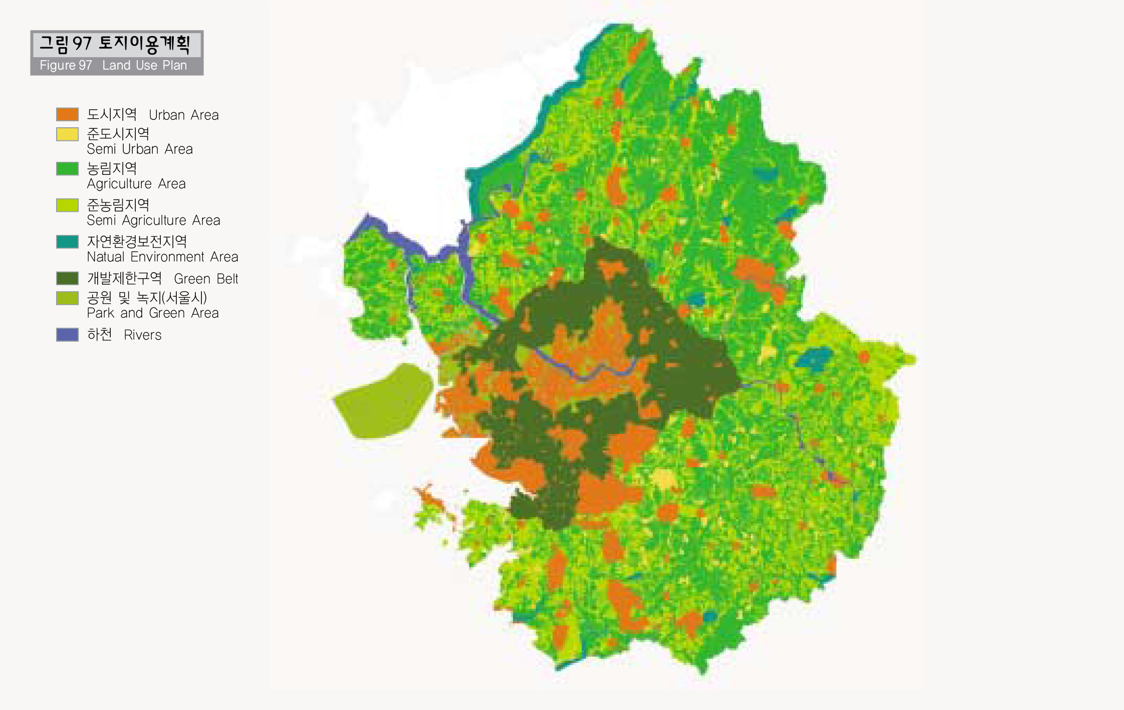
토지이용
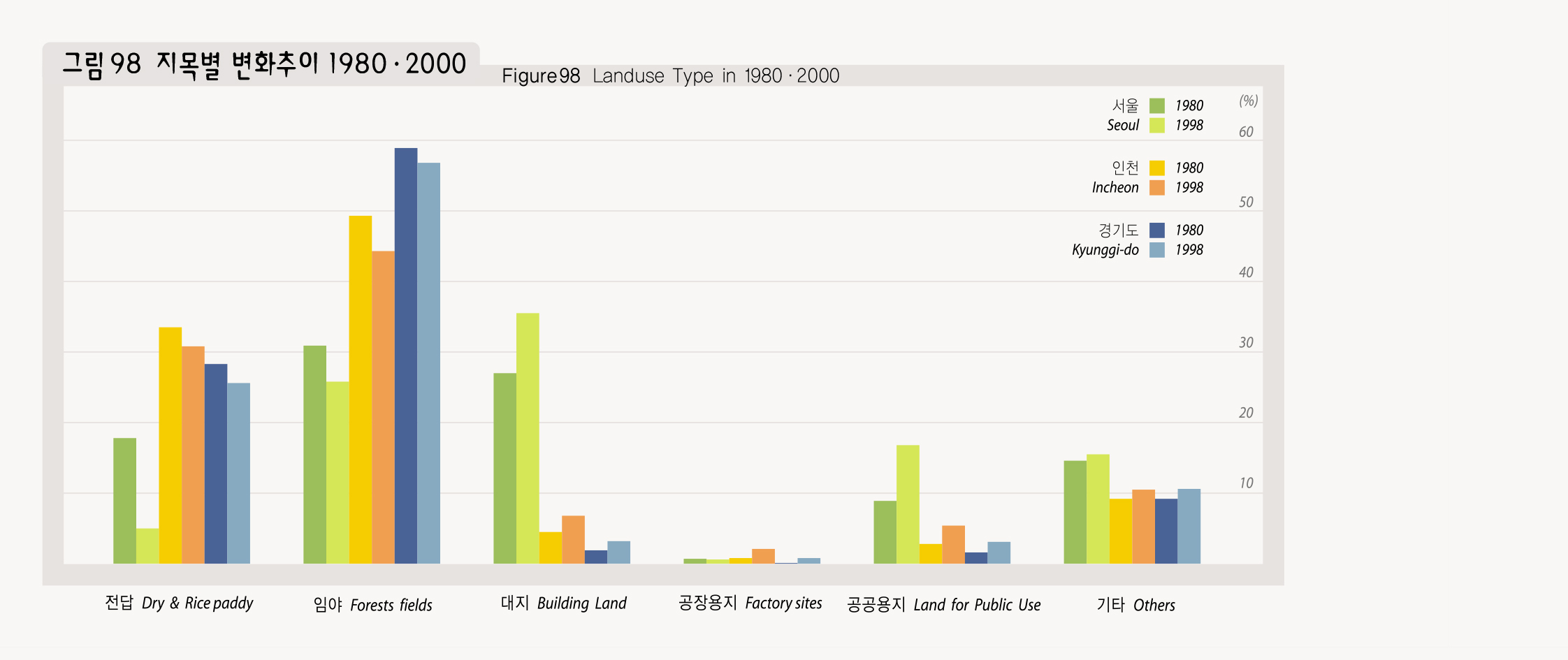
수도권의 지목별 토지이용 변화추이를 살펴보면 전∙답, 임야면적은 감소하며, 대지면적은 지속적으로 증가하는 추세이다.
특히 서울시는 전답면적 비율이 80년과 98년 사이 12%가 감소하였으며, 경기도 전체로도 2.5%가 감소하였다. 반면 대지와 공공용지 면적은 서울은 같은기간에 약 8%, 경기도는 1.5%의 증가를 보여주고 있다.
이러한 토지이용의 변화는 특히 간선도로 주변을 따라 심하여, 시가화지역을 중심으로 토지이용변화를 살펴보면 기존의 경인, 경부선 축 뿐 아니라 고양방면의 경의축, 이천방면의 중부축, 동두천 방면의 경원축으로 분산화되어 퍼져 나가고 있어, 개구리 뜀뛰기 식으로(leap-frog) 도시화가 진행되고 있음을 알 수 있다.
Land Use
Studies of the change of land use in the metropolitan areas shows that the land for rice cultivation and dry field farming decreased while housing sites continue to increase.
In particular, between 1980 and 1998, the ratio of dry fields and paddy fields in Seoul decreased by 12%, Kyonggi-do 2.5% decrease. On the contrary, housing site and the land for public use increased 8% in Seoul and 1.5% in Kyonggi-do for the same period.
Such change in land use is particularly distinctive along the main roads and it keeps spreading not only in the urbanized areas along the Seoul-Incheon and Seoul-Pusan express ways but along the Kyongui(Seoul-Uiju) axis in the direction to Koyang, Chungbu axis to Incheon, and Kyongwon axis to Dongduchon, showing urbanization in the leap-frog pattern.
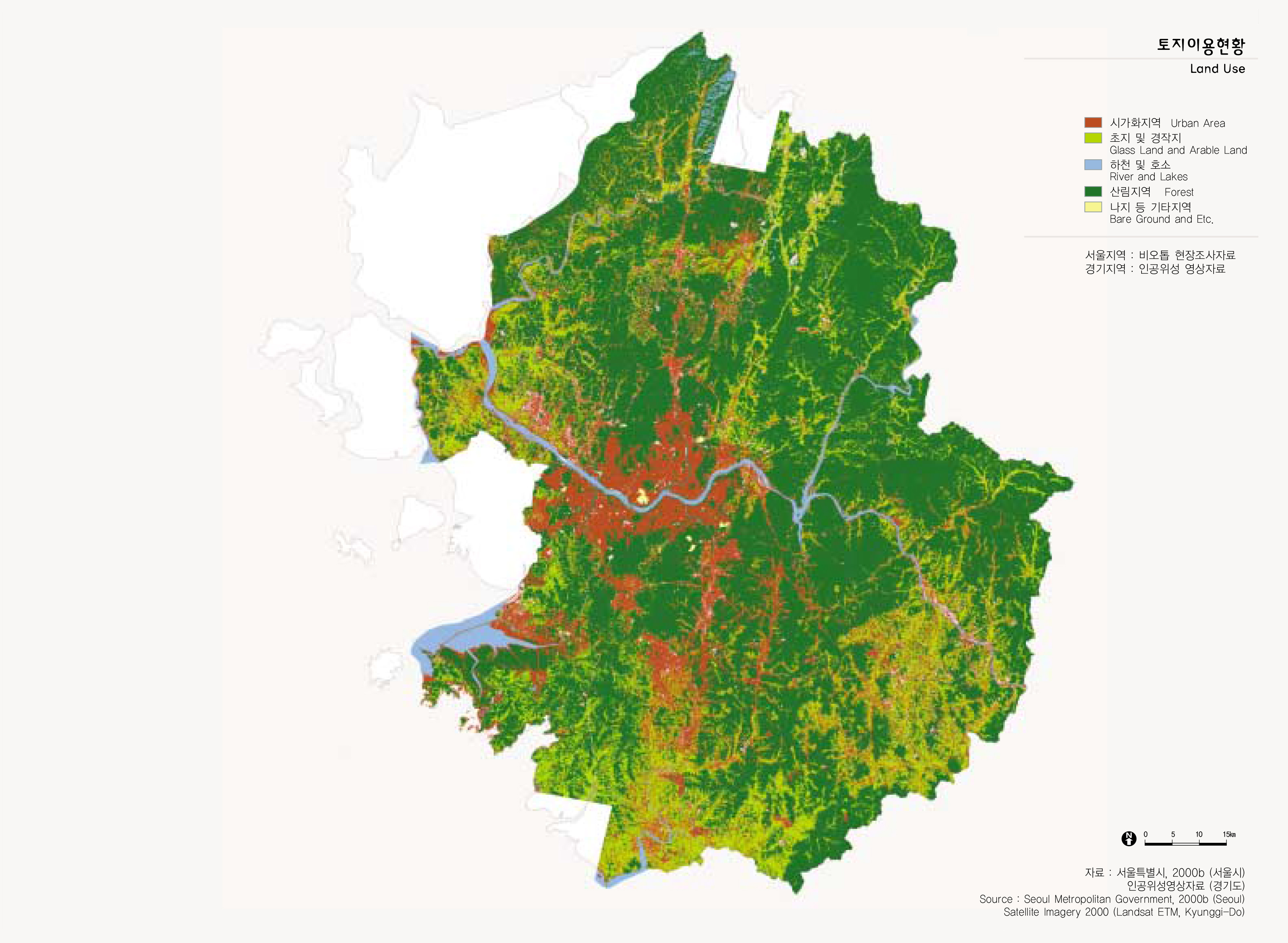
출처 : 서울특별시, 2000b (서울시)
인공위성영상자료 (경기도)