- 토지이용
도시계획
-
도시계획
도시계획이란 한 도시의 바람직한 미래상을 정립하고 시민의 안녕과 복리를 증진시키기 위해서 합리적인 토지이용규제를 통해서 도시를 관리하는 일련의 과정이라고 할 수 있다. 보통 도시계획은 관련법규에서 규정한 절차와 규제내용을 정한 법정계획을 말하며, 크게 도시기본계획과 도시관리계획이 있다. 현재 서울시는 2020서울도시기본계획이 수립되어 있으며, 이를 집행하기 위한 하위계획으로 도시관리계획이 수립되어 있다. 대표적인 도시관리계획에는 도시차원에서 용도와 밀도를 정하는 용도지역·지구에 관한 지정계획과 특정한 지역의 개발 및 관리를 목적으로 하는 지구단위계획 등이 있다.
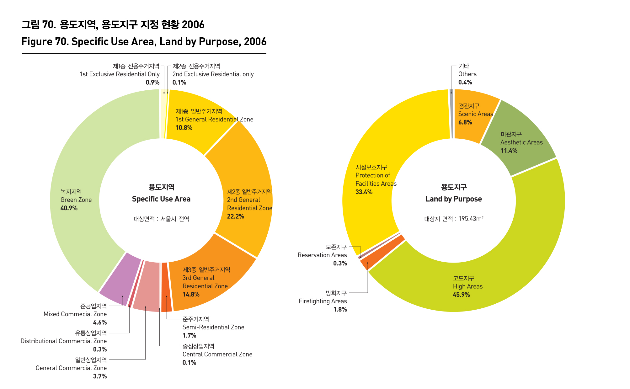
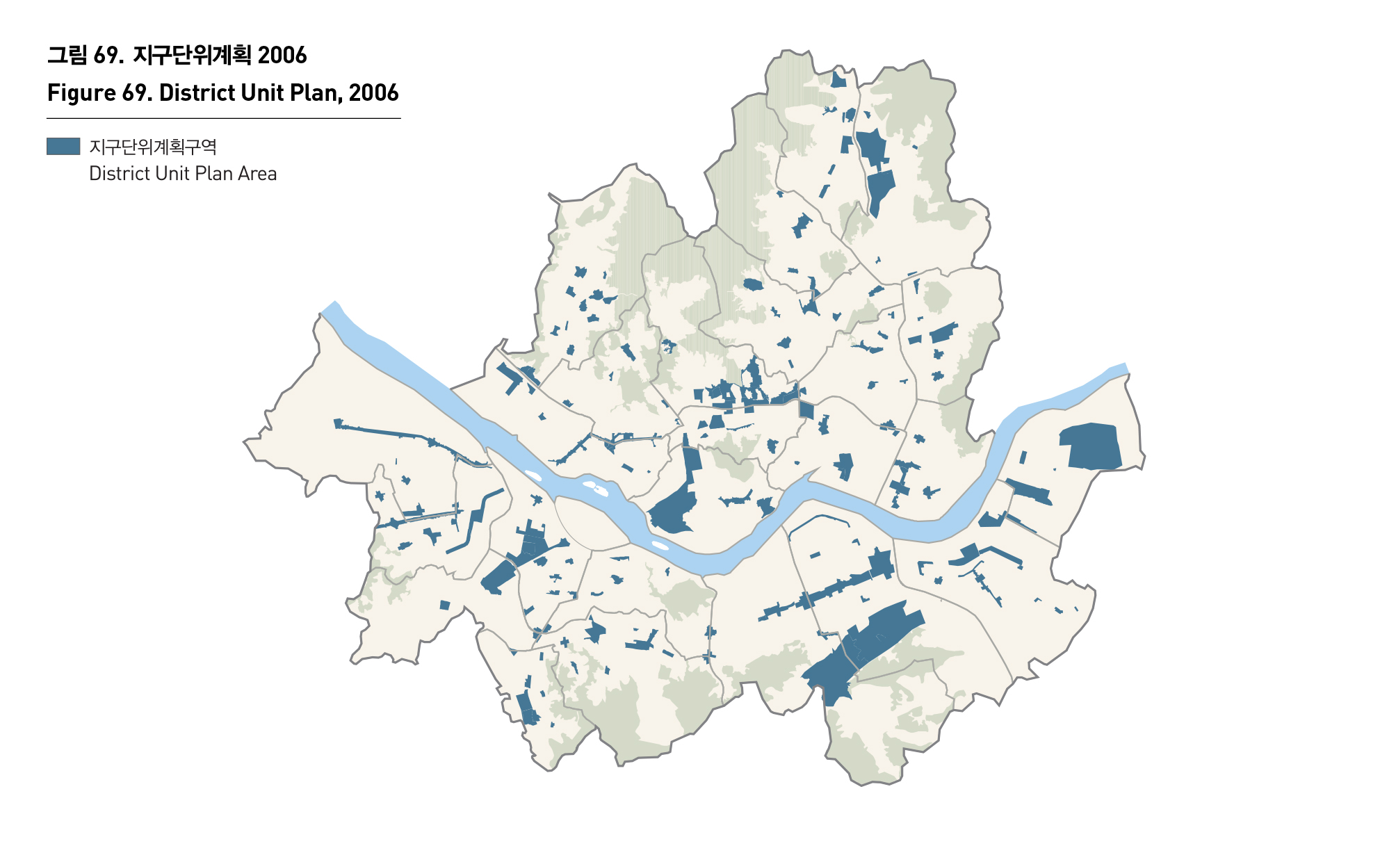
서울시의 도시관리계획상 용도지역의 지정현황을 보면 주거지역 50.4%, 녹지지역 40.9%, 준공업지역 4.6%, 상업지역 4.1% 등의 순으로 지정되어 있으며, 용도지역의 기능을 보완하기 위해 지정되는 용도지구는 고도지구45.9%, 시설보호지구 33.4%, 미관지구 11.4%, 경관지구 6.8% 등의 순으로 넓게 지정되어 있다. 한편, 지구차원의 도시관리를 위한 지구단위계획 역시 다양한 형태로 수립되어 시행되고 있다.
CITY PLANNING
City planning means processes of managing a city by the rational regulation of land use with the aim of establishing a desirable future image and promoting the public health and welfare. In general, city planning sets forth regulations and procedures stipulated in the relevant law, and can be largely divided into a basic city plan and a city management plan. Seoul established 2020 basic Seoul city plan, and came up with a city management plan as a means of implementing the basic plan. The representative city management plan includes a designation plan under which Seoul determines the use and density of a zone and district, and a district unit plan with the objective of developing and managing a specific area.
According to Seoul’s city management plan, residential zones are designated to constitute 50.4%, green zones 40.9%, mixed commercial zones 4.6% and commercial areas 4.1% of lands in Seoul. When it comes to a district, high areas account for 45.9%, facility protection areas 33.4%, aesthetic areas 11.4%, and scenic areas 6.8%.


출처 : 서울특별시, 지구단위계획종합운영계획, 2006
서울시정개발연구원 내부자료
서울특별시 도시계획국
서울특별시, 서울통계연보, 2007