-
수도권
광역교통망
-
광역교통망
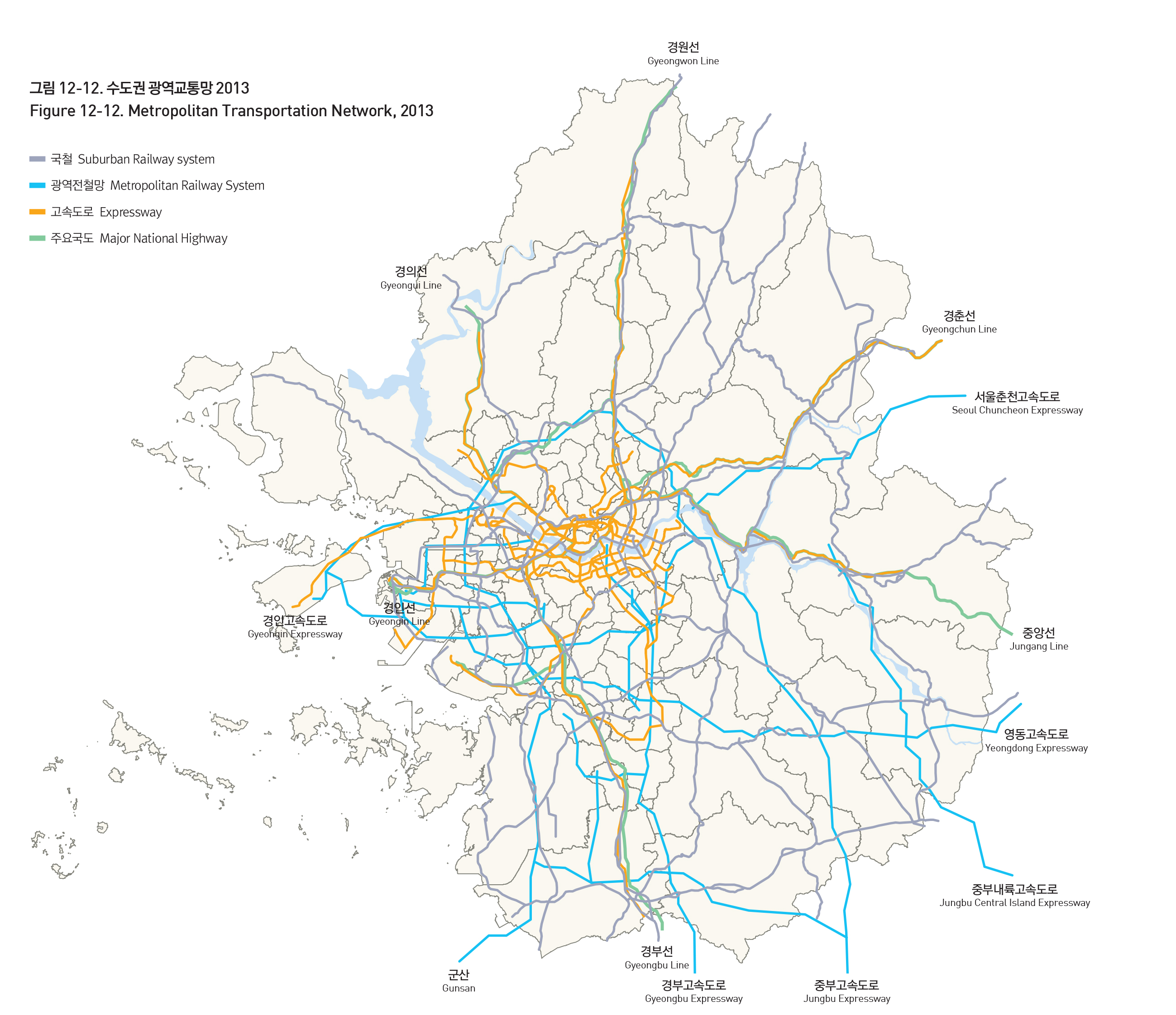
수도권의 생활권이 확대되면서 광역교통망 체계의 정비가 날로 중요해지고 있다. 수도권의 광역교통망은 크게 지하철 및 국철, 전철을 포함하는 철도체계와 고속도로, 국도를 포함하는 도로체계로 나눠볼 수 있다. 수도권 전철망은 서울시(1~9호선) 및 인천시(인천1호선)가 운행하는 도시철도 353.6km, 코레일, 코레일공항철도(주), 신분당선(주)이 관리하는 611.9km로 구성되어 있다(2013년 서울도시철도 수송계획).
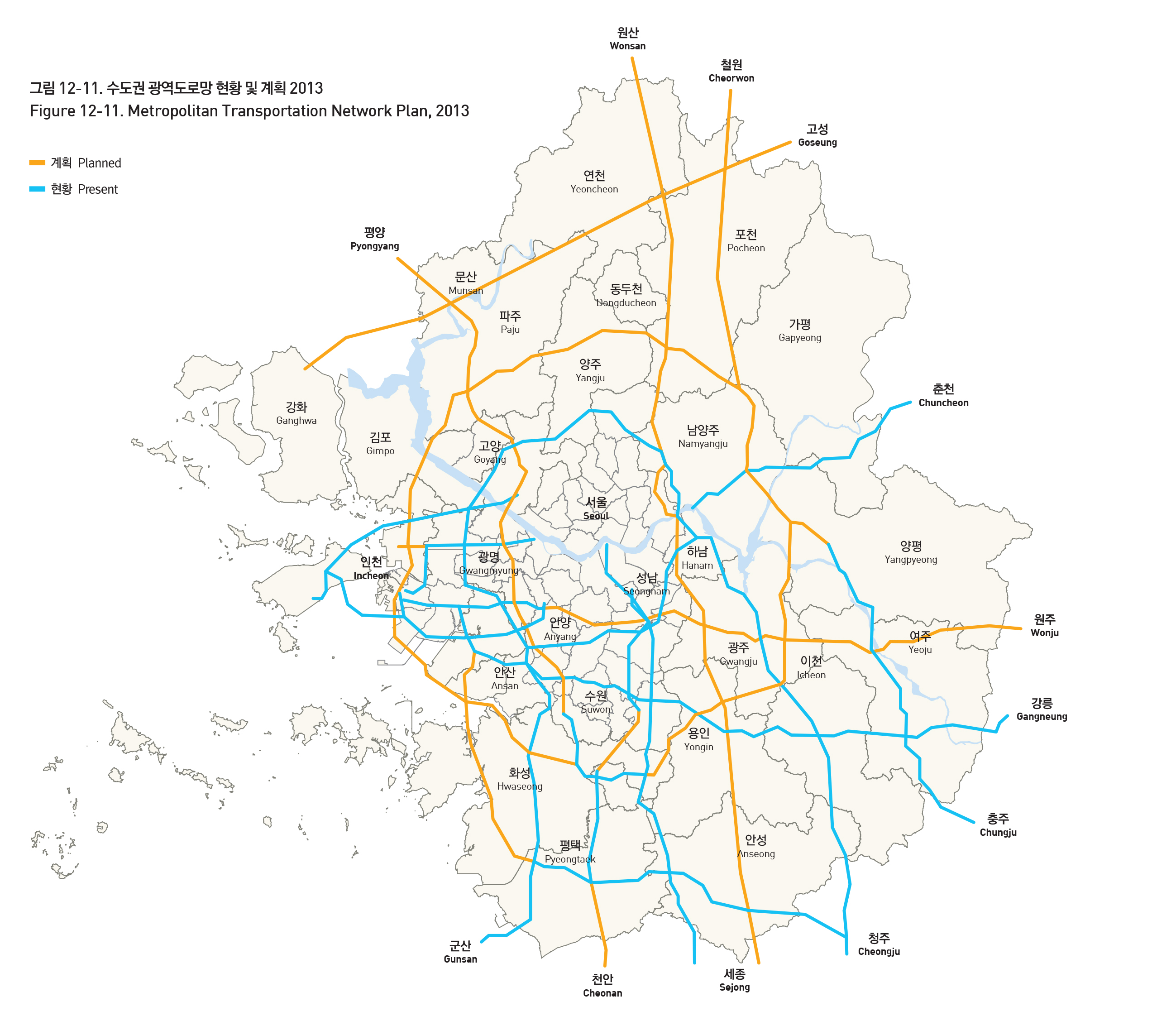
한편 수도권 고속도로망은 외곽순환고속도로, 서해안고속도로, 경부고속도로 등 총 755km가 운영 중에 있다(국토교통부 통계자료, 2012년 기준). 국토교통부에서는 광역교통문제에 대처하기 위해 남북 7축, 동서 4축, 3개 순환망 등 간선도로망을 확충하여 2020년까지 간선도로 총연장을 1,811km까지 늘이는 수도권 간선도로망 체계 구축을 계획하고 있다.
METROPOLITAN TRANSPORTATION NETWORK
As the daily commutable area within the metropolitan area extends, the organization of the metropolitan transportation network has become ever more important. The metropolitan transportation network of Seoul metropolitan area largely consists of a railway system and a road system. The metropolitan subway network is made up of 353.6km of subway rails run by Seoul and Incheon metropolitan governments, and 611.9km of subway rails run by Korail, Airport Express, and Shinbundang Line. (2013 Seoul Metropolitan Rapid Transit Corporation Transportation Plan)
Meanwhile, the metropolitan area highway network consists of 755km in road length (from the Ministry of Land, Infrastructure and Transport, 2012). In order to address traffic problems, the ministry plans to extend the arterial road network to 1,811km along 7 north-south axes, 4 east-west axes, and 3 circular networks.
출처 : 국토교통부, 제3차 수도권 정비계획(2006-2020)
출처 : 국토교통부, 제3차 수도권 정비계획(2006-2020)


