
-
자연
지형
-
지형
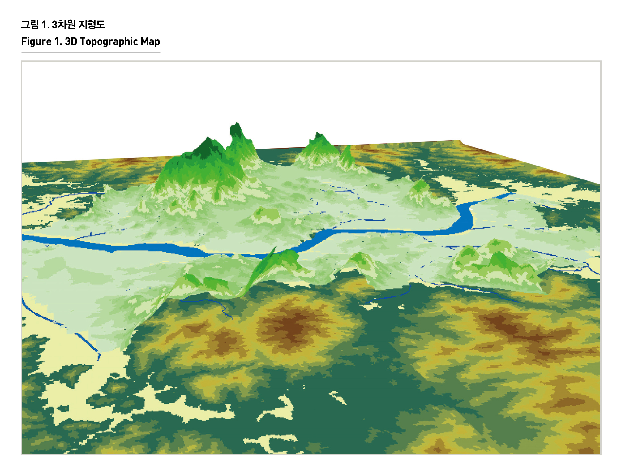
서울은 산악에 둘러싸인 분지지형을 이루고 있다. 강북의 중앙에 동서남북으로 각각 낙산(111m), 인왕산(338m), 남산(262m), 북악산(342m)이 있는데, 이 내부 분지는 조선시대에 궁궐과 한성부의 주요시설들이 위치했던 곳이다. 행정경계를 중심으로 북쪽으로는 북한산(837m), 도봉산(740m), 동북쪽으로는 수락산(638m), 불암산(508m), 남쪽으로는 관악산(629m)과 청계산(493m)이 경기도와 경계를 이루며, 이 산악지형 사이를 한강이 동서로 흐르고 있다. 그리고 이들 산지 사이를 한강의 지류인 청계천, 중랑천, 불광천, 안양천, 탄천, 양재천 등이 흐르고 있다.
TOPOGRAPHY
Seoul is surrounded by Mt. Naksan(111m) in the East, Mt.Inwangsan(338m) in the West, Mt. Namsan(262m) in the South and Mt. Bukaksan(342m) in the North. The royal palaces of Joseon Dynasty and major facilities of Hanseongbu(old name of Seoul) are located in the basin. There are Mt.Bukhansan(837m) and Mt. Dobongsan(740m) in the North, and Mt. Suraksan(638m) and Mt. Bulamsan(508m) in the northeast, and Mt. Gwanaksan(629m) and Mt. Cheonggye san(493m) in the South, bordering on Gyeonggi-do. The Han river flows from the east to the west between the mountains. There are also tributary streams of Han river running between the mountains, such as Cheonggyecheon, Jungrangcheon, Bulgwangcheon, Anyangcheon, Tancheon and Yangjaecheon.

출처 : 서울시정개발연구원 내부자료