-
교통
도로시설
-
도로시설
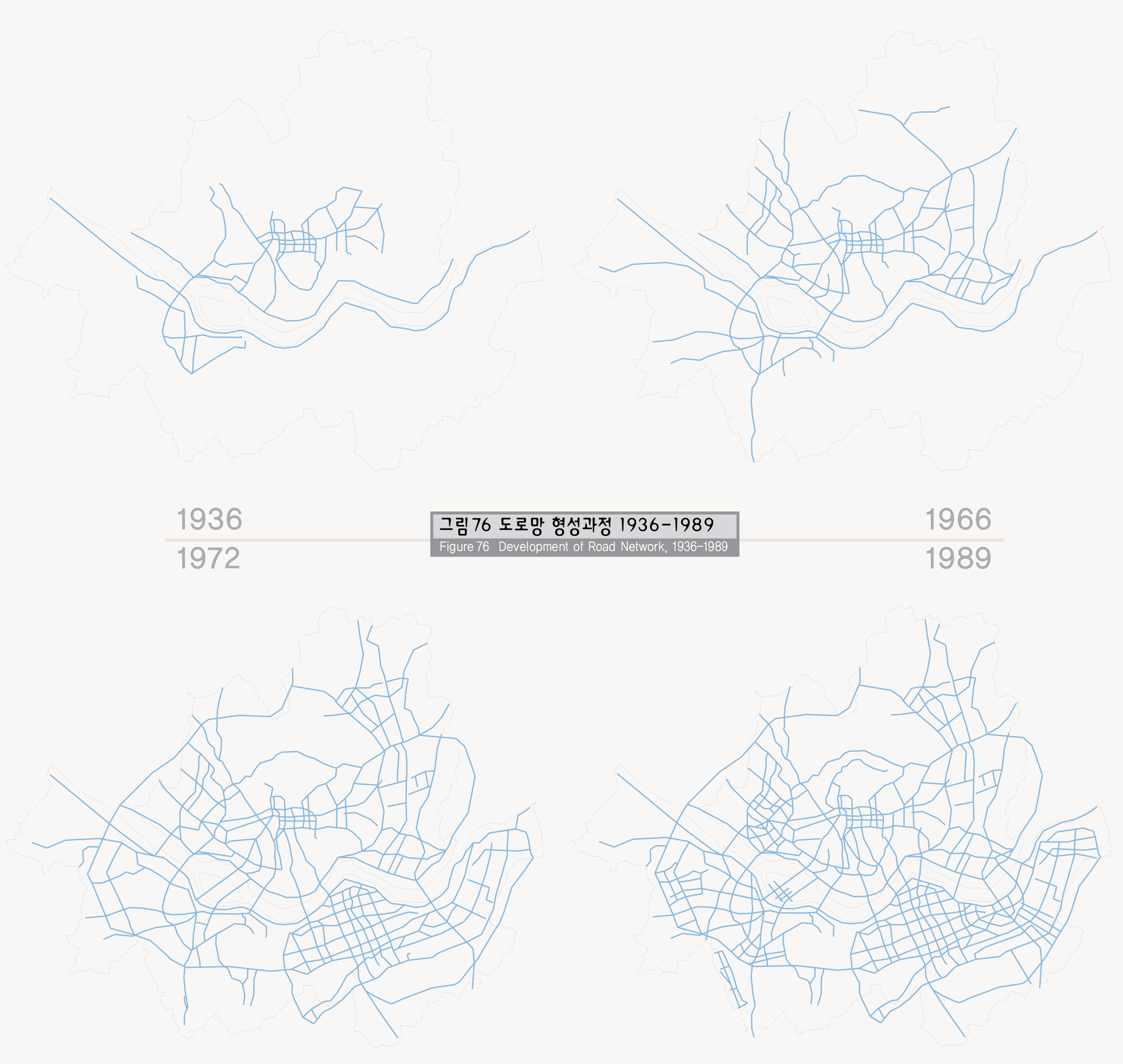
서울의 도로망은 방사형, 격자형, 순환형 도로들이 혼합된 형태이며, 이는 도시의 형성과정과 연관이 있다. 1930년대에는 4대문 안과 마포, 영등포 등 일부 외곽지역에만 도로가 연결된 형태에서 점차 강북지역에 도로망이 형성되는 과정을 거쳐 80년대에는 강남지역에 격자형 도로망이 발달되었으며, 90년대 도시고속도로를 비롯한 간선도로 정비를 통하여 오늘에 이르고 있다.
도로망 체계를 보면 외곽순환, 내부순환도로가 환상축을 형성하고, 강변북로와 올림픽대로가 동서방향의 간선축을 이루며, 동부간선, 서부간선, 그리고 최근 개통된 북부간선 도로가 차량이동의 중추기능을 담당하고 있다.
서울의 2000년 현재 도로길이는 7,844Km이며 시가화면 적에 대한 도로면적으로 계산한 도로율은 해마다 증가하여 현재 약 21%에 이르고 있다.
Roads
The roads of Seoul show a combined pattern of radial roads, cross stripe roads, and a ring type road, and it is closely related to the formation process of Seoul. In the 1930s, roads were inside the Four Gates and they were connected to limited regions such as Mapo and Yeongdeungpo. Roads were gradually expanded to the northern areas of Seoul and in the 1980s cross stripe type roads were built in the Gangnam region. In the 1990s, city highways were added and main roads were expanded and repaired. Seoul's road networks are made up of an outer ring circular road and an inner ring circular road around Seoul while the Kangbyonbukno(north of the Han River road) and the Olympic road form an axis that crosses Seoul in east-west direction. In addition, the Tongbu main road, Sobu main road, and the recently opened Pukbu main road, form a backbone for transportation.
As of 2000, the total length of roads in Seoul amounts to 7,844Km and the road rate, which reflects the percentage of land in use as road vs built-up area has increased annually and presently stands at 21%.
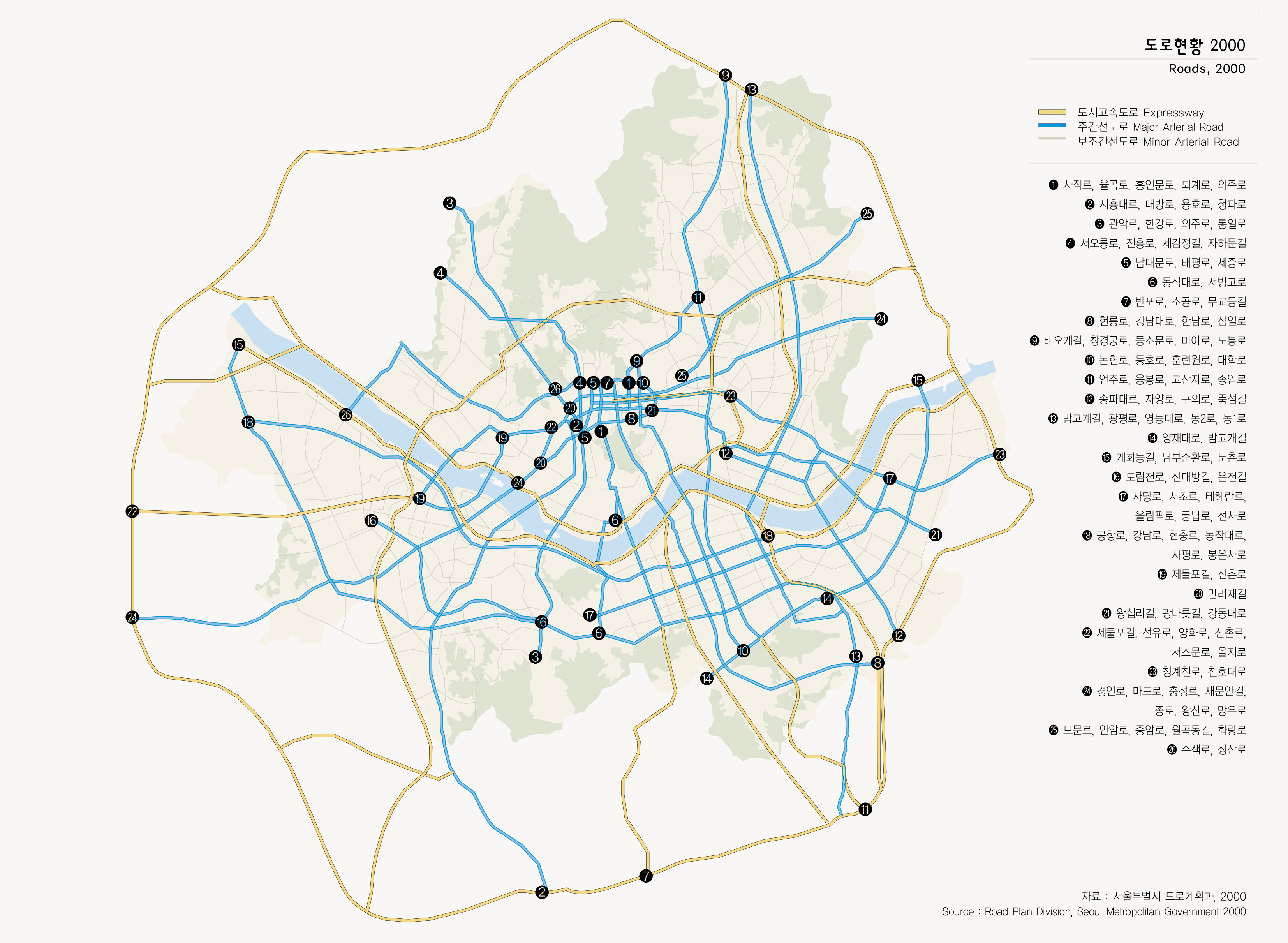
출처 : 서울특별시 도로계획과, 2000