-
토지이용
토지이용
-
토지이용현황
한 도시의 토지이용 현황을 파악하는 것은 도시관리를 위해 매우 중요하다. 서울시에서는 환경을 고려한 도시관리의 기초자료로서 1999년 도시생태지도를 제작하였으며, 그 일환으로 서울시 전역에 대한 토지이용현황을 조사하였다. 그 결과를 보면 녹지 및 오픈스페이스 지역이 41.9%, 주택지 26.9%, 교통시설지 10.2%, 상업업무지 5.9%, 공공용도지 5.1%의 순으로 넓은 면적을 차지하고 있다.
토지이용 분포를 살펴보면 도시화 지역은 서울을 동서로 가로지르는 한강과 각 지천 인근의 저지대에 위치하며, 산림은 서울시 외곽에 위치하여 전체적으로 산림이 도시화 지역을 둘러싸고 있다.
Land Use
Analysis on the land use is significant in city management. To use as a reference for environment management, Seoul city drew up biotope maps in 1999 and as part of the project it has conducted studies on the status of land use throughout Seoul. The results show that forest and open space co-nstitutes 41.9%, residential area 26.9%, transportation facilities area 10.2%, commercial and business area 5.9%, and public facilities area 5.1%.
In terms of the distribution of land use, the urbanized areas stretch in the lower regions of the Han River that divides Seoul from the east and west, and the tributaries of the Han River while forests are situated in the outskirts of Seoul, surrounding the urbanized areas.
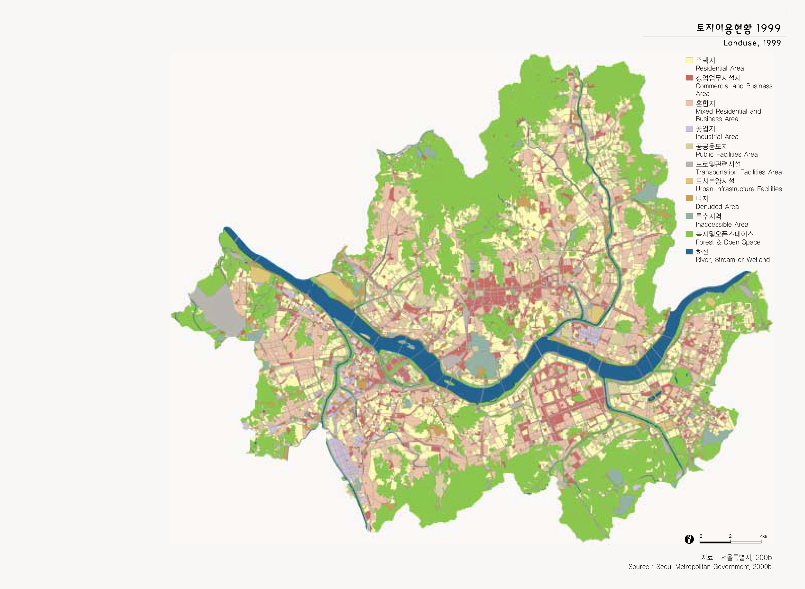
출처 : 서울특별시, 2000b