
-
역사
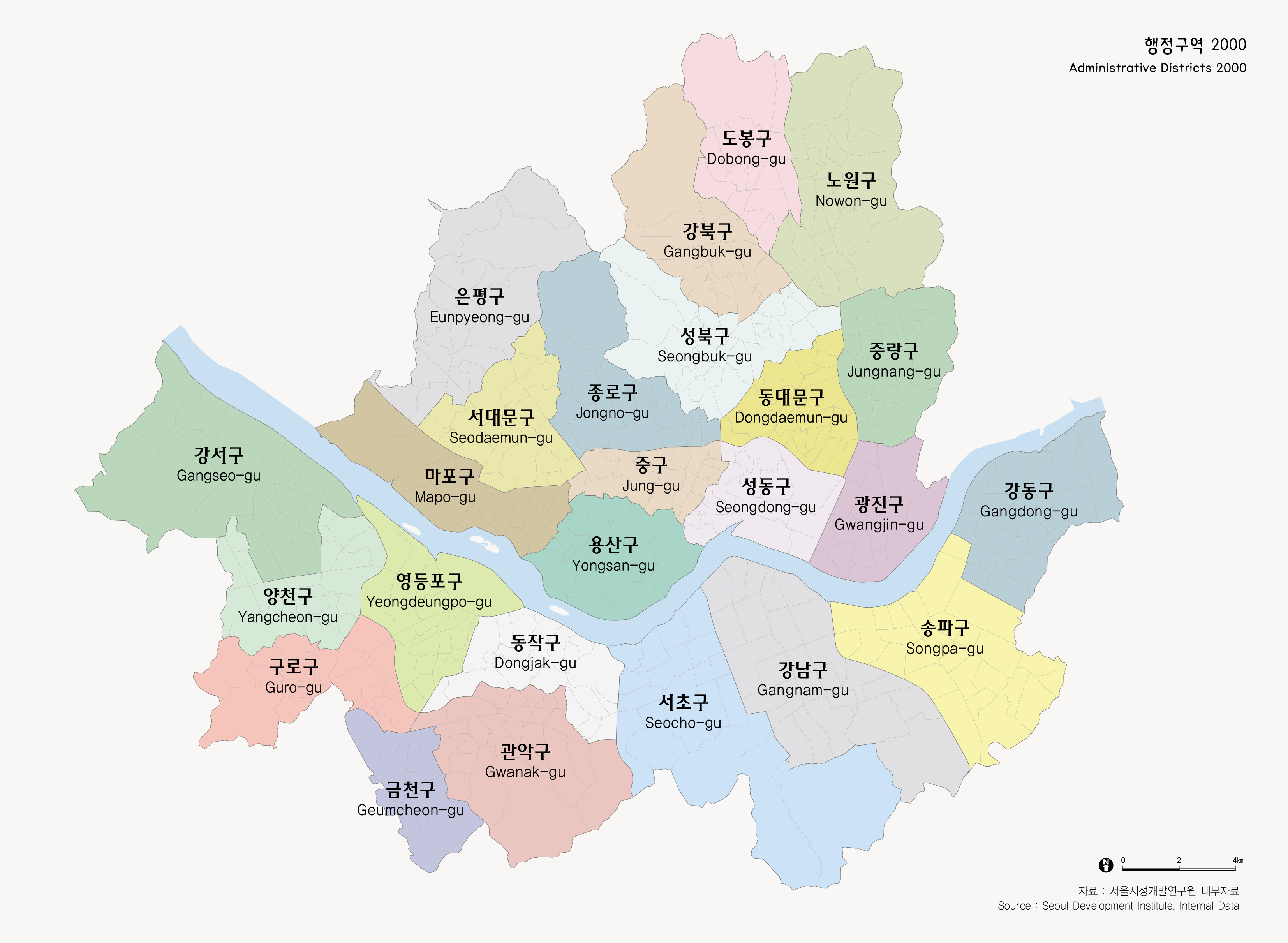
현행 행정구역
-
현행 행정구역
서울은 1949년 현재와 같이 서울특별시로 개칭된 이래 행정구역에 많은 변화를 겪게 된다. 1943년부터 현재와 같은 區制가 실시되어 종로구, 중구, 동대문구, 용산구, 성동구, 영등포구, 서대문구의 7개구가 신설된 이후 마포구(1943), 성북구(1949), 도봉구와 관악구(1973), 강남구(1975), 강서구(1977)가 추가되고, 1979년에는 은평구, 구로구, 동작구, 강동구, 1988년에는 중랑구, 노원구, 양천구, 서초구, 송파구가, 그리고 1995년에는 금천구, 강북구, 광진구가 추가되어 현재와 같은 25개구 522개의 행정동을 갖는 행정편제를 갖게 된다. 이와 같은 행정구역의 변화는 도시화가 진행되면서 나타난 서울의 급격한 인구증가를 반영한다. 행정구역의 경계는 인구의 크기에 따라 여러차례 분할되어 그 면적이 일정치 않다.
Present Administrative Districts
Since 1949 when Seoul was renamed to the present name Seoul Metropolitan Government, Seoul has experienced many changes in administrative areas. From 1943, the present 'Gu'system was put in place and Seoul came to have 7 gu(s) of Chongno-gu, Chung-gu, Dongdaemun-gu, Yongsan-gu, Songdong-gu, Yeongdeungpo-gu, and Seodaemun-gu. Later Mapogu(1943), Seongbuk-gu(1949), Dobong-gu and Gwanak-gu(1973), Gangnam-gu(1975), Gangseogu(1977) have been added. Additions continued with Eunpyeong-gu, Guro-gu, Dongjak-gu, Gangdong-gu in 1979 and Jungnang-gu, Nowon-gu, Yangcheon-gu, Seocho-gu, Songpagu in 1988, and Geumcheon-gu, Gangbuk-gu, Gwanagjin-gu in 1995 have been incorporated into Seoul, bring the total to 25 gu(s) and 522 dong(s). Such changes in administrative area reflect the sudden population increase of Seoul in the course of urbanization. Administrative districts are divided by population size, and each has different sizes.
출처 : 서울특별시, 2000c