-
자연
바람
-
바람
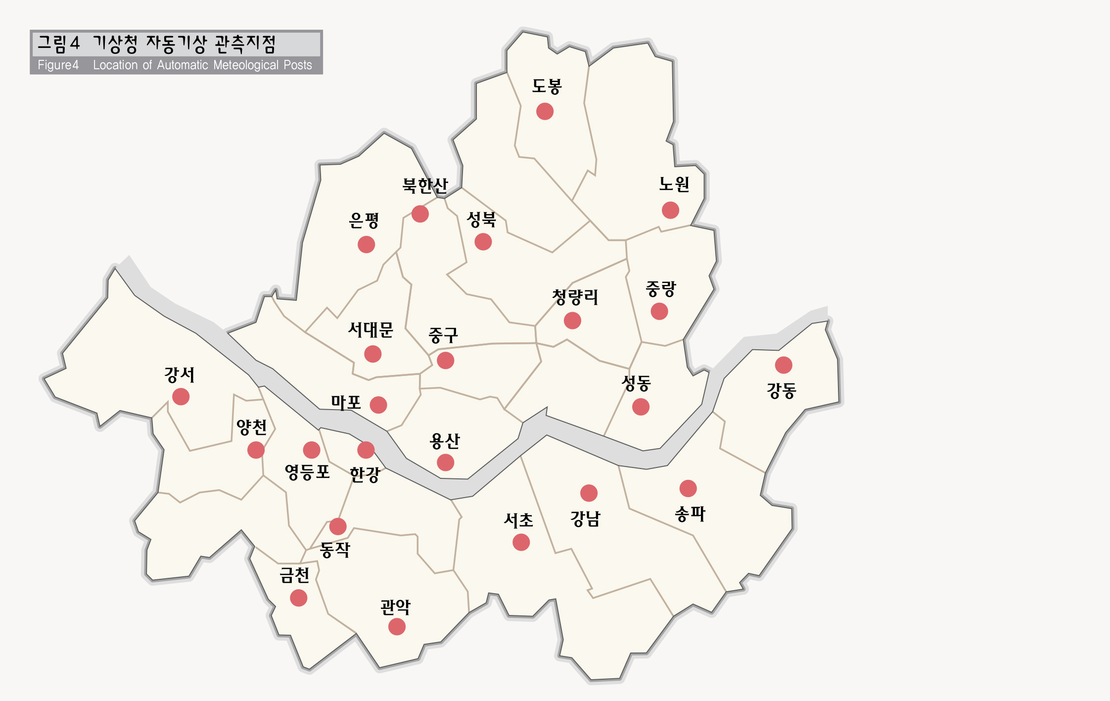
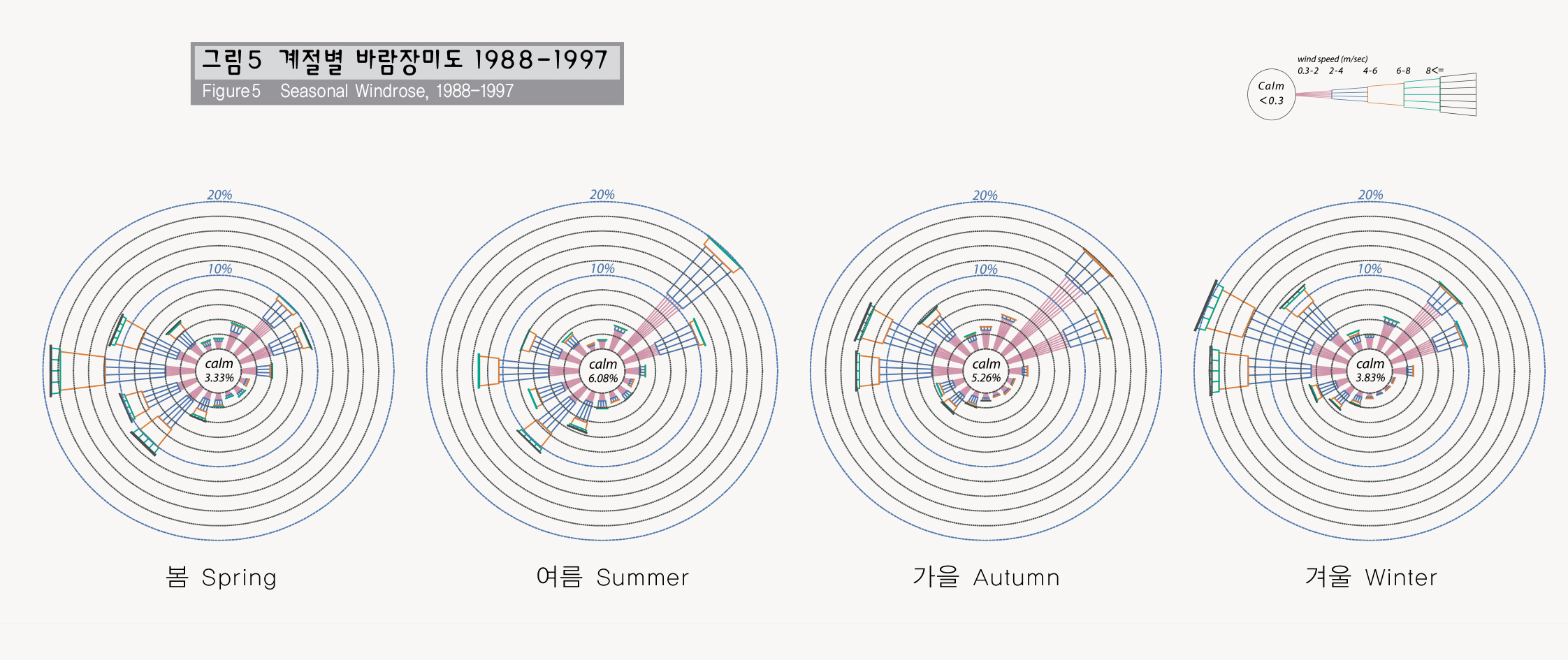
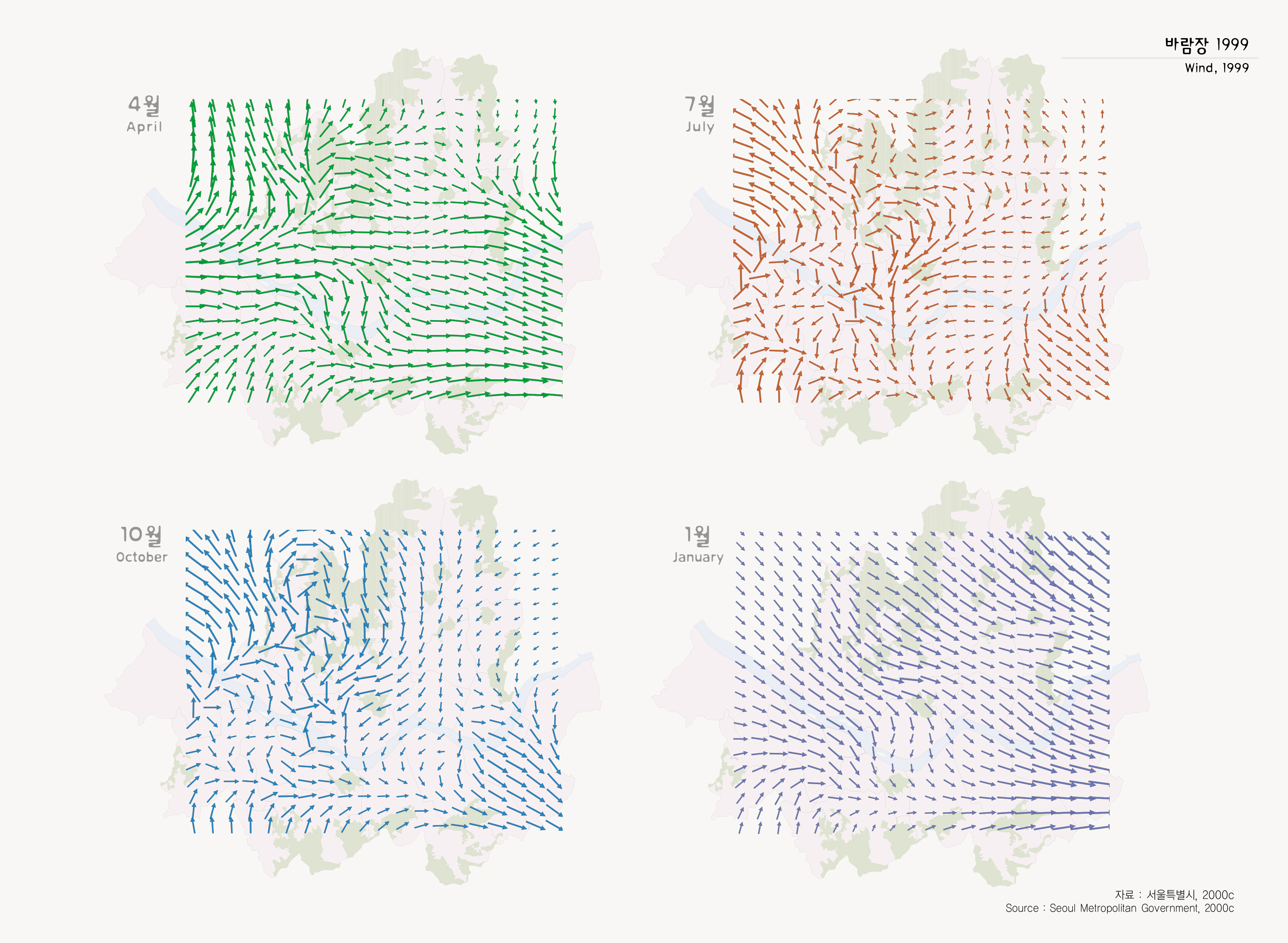
도시내에서 바람의 방향은 오염물질의 이동과 밀접한 관련을 갖으며, 바람이 정체되는 지역은 오염농도가 높아질 가능성이 있다. 1988년부터 1997년까지 자동기상관측망에서 관측된 자료를 보면 연평균 풍속은 2.3m/s이며, 4월에 바람이 가장 세게 불었으며, 9월 바람이 가장 약한 세기를 나타낸다. 최다풍향은 서풍이며, 계절별로는 봄 여름 가을 겨울에 각각 서풍 북동풍 북동풍 서북서풍의 빈도가 높다. 1999년 바람장을 계절별로 살펴보면 봄 여름에는 남서풍이, 가을 겨울에는 북서풍의 빈도가 높다.
서울의 바람은 한강을 따라 형성되는 바람장이 매우 우세하며, 한강의 지류인 중랑천 탄천을 따라 바람이 이동한다. 중랑천을 따라 흐르는 바람은 도봉산 아차산 수락산에서 형성된 산골바람과 만나 상계동 지역에서 일부 와류현상을 보이고 있다.
Wind
The directions of the wind in a city heavily influence the movement of pollution materials, and where wind stays tends to show a higher density of pollution. According to the observed results at the automatic meteorological posts between 1988 and 1997, annual wind speed was 2.3m/s, April has the strongest wind while September is the month with the least wind. A west wind is found to be the most prevailing wind while west wind during the Spring, the northeasterly wind during summer and autumn, and west-north-west wind in winter are prominent. In the case of 1999, southwesterly wind in spring and summer, the northwesterly wind in autumn and winter were frequent.
The wind formed along the Hangang River prevails and the wind moves along the Chungnangchon Stream and Tanchon Stream, both are tributaries of the Hangang River. The wind blowing along the Chungnangchon meets with valley winds that are from Mt. Tobongsan, Mt. Achasan, and Mt.Suraksan, and the turbulence phenomena that occur at times in the Sanggye-dong area.
출처 : 서울특별시, 2000c