-
자연
기온 및 강수량
-
기온 및 강수량
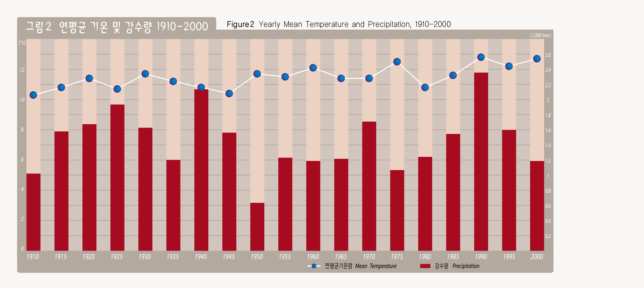
서울의 기후는 남부지방의 난대성 기후와 북부지방의 냉대성 기후의 중간적 성격을 나타내어 비교적 사계절이 뚜렷하고 연간 기온차가 크며, 삼한사온의 대륙성 기상현상을 보인다.
1999년 서울시 23개 기상관측망에서 관찰한 계절별 수평기온분포는 도심지로 갈수록 기온이 높고 교외로 갈수록 낮으며, 특히 영등포, 양천 등 서쪽지역과 청량리 중심의 강북지역, 그리고 서초 강남지역 등에서 기온이 높게 나타나고 있다. 이러한 고온역 분포는 도시열섬효과의 결과이며, 고층건물의 축조, 도로 포장, 나무 초지 감소 등과 같은 토양피복도와 밀접한 관련이 있다.
Temperature and Precipitation
The climate of Seoul shows the characteristics of somewhere in between the sub-tropical climate in the south and cold weather in the north. It has relatively distinctive four seasons, a large annual temperature difference, and continental climate with a cycle of three cold days and four warm days.
According to the observated results of the 23meteorological observation posts in Seoul in 1999, the seasonal average temperature by latitude shows that temperatures get higher as it goes toward downtown, while temperatures get lower as it goes out to the suburbs, in particular, the western part of Seoul such as Yeongdeungpo and Yangchon. North of th Hangang River center around Chongnyang-ri, and Seocho and the Gangnam region shows higher temperatures. The high temperatures are the result of heat island phenomenon and are also closely related to the construction of high-rises, paved road, and reduced flora areas.
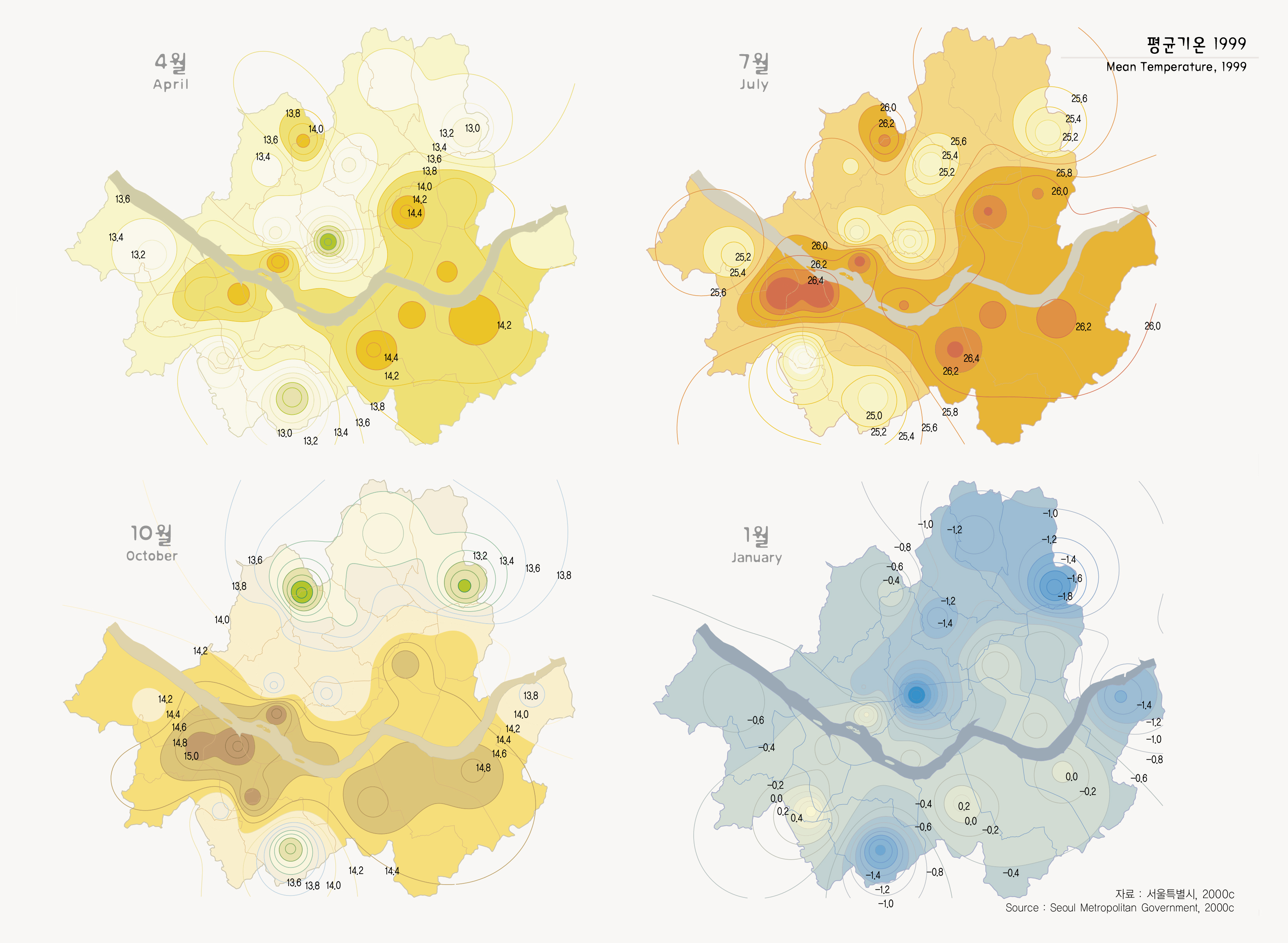
출처 : 서울특별시, 2000c